Sokolata (Unique identification code in the register: 46)
Category: Reserve
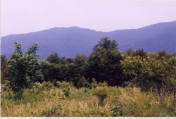
Area: 219.59 hectares Location:
District: Blagoevgrad, Municipality: Strumyani, Locality: Igralishte
Falls in the territory of the following Regional Inspectorates of Environment and Water (RIEW):
Blagoevgrad - ul."Svoboda" № 1
Falls in the territory of the following Regional Forestry Directorates (RFD):
RFD Blagoevgrad: SFE Tsaparevo
Ordinance for announcement:
Ordinance No.115 from 18.02.1985
 115-1985
Ordinance for change:
1.
Change in the area - actualisation with Ordinance No.РД-207 from 04.03.2013
207-2013
2.
Accepting the management plan with Ordinance No.РД-33 from 21.01.2016
33-2016
Management plan for protected area (link):
Aims of the declaration:
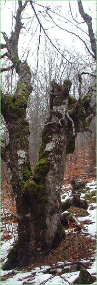
1. Venerable high-stem blagun forest in the region of mountain Malashevska-local ecotype blagun.
Current prohibitions and regimes:
1. All activities are prohibited in the forest reserve except:
1. its conservancy;
2. visits with a scientific purpose;
3. people walking on the designated paths, including when it's with an educational purpose;
4. collection of seeds, wild plants, and animals with a scientific purpose
Overlapping (partial or full):
PZ under the Habitat Directive: Ograzhden - Maleshevo
|


 Български
 Contacts
 Превод на български