Ostritsa (Unique identification code in the register: 19)
Category: Managed Nature Reserve
Area: 135.99 hectares Location:
1.
District: Pernik, Municipality: Pernik, Locality: Kralev dol, Pernik
2.
District: Pernik, Municipality: Radomir, Locality: Radomir
Falls in the territory of the following Regional Inspectorates of Environment and Water (RIEW):
Sofia - rayon Pernik - ul."Blagoy Gebrev" № 15, et.1
Falls in the territory of the following Regional Forestry Directorates (RFD):
RFD Kyustendil: SFE Radomir
Ordinance for announcement:
Ordinance No.318 from 20.02.1961
 318-1961
Ordinance for change:
1.
Re-categorization with Ordinance No.318 from 20.02.1961
318-1961
2.
Change in the area - increase with Ordinance No.775 from 29.03.1972
775-1972
3.
Re-categorization with Ordinance No.378 from 15.10.1999
378-1999
4.
Accepting the management plan with Ordinance No.РД-590 from 04.07.2002
590-2002
5.
Change in the area - actualisation with Ordinance No.РД-41 from 19.01.2015
41-2015
Management plan for protected area (link):
Aims of the declaration:
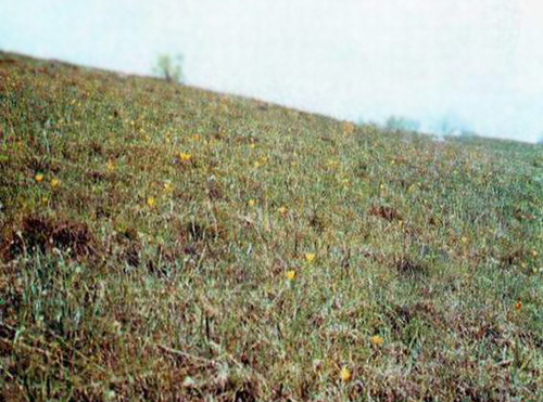
1. Natural habitat of valuable plant specimens.
Current prohibitions and regimes:
1. Until a plan for the management of the natural reserve has been created, the following activities are allowed:
1. Maintenance activities, aimed at preserved the valuable grass species and societies;
2. Grazing sheep after July 20;
4. Control the number of wild boars from 1 october to 31 december.
Overlapping (partial or full):
PZ under the Habitat Directive: Ostritsa
|


 Български
 Contacts
 Превод на български