ExEA ExEA EEA

Register of protected areas in Bulgaria


Final result


Aramliets   (Unique identification code in the register: 276)

Category: Protected Site

Map:

Map of the object
Digital boundaries - WGS 84, UTM 35N (shp)

Digital boundaries are with the current status


Area: 140.8 hectares

Location:
1. District: Pazardzhik, Municipality: Panagyurishte, Locality: Poibrene
2. District: Sofia, Municipality: Ihtiman, Locality: Belitza
3. District: Sofia, Municipality: Mirkovo, Locality: Kamenitsa

Falls in the territory of the following Regional Inspectorates of Environment and Water (RIEW):
1. Pazardzhik - ul. "Gurko" № 3 et.4 p.k.220
2. Sofiia - bul."Tsar Boris III" №136

Ordinance for announcement:
Ordinance No.2419 from 12.12.1969 2419-1969

Ordinance for change:

Re-categorization with Ordinance No.РД-411 from 03.04.2003 411-2003

Aims of the declaration:
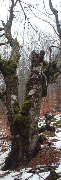
1. Conservation of the characteristic landscape.

Current prohibitions and regimes:
1. It is prohibited to lumber, except with the purpose of improving the sanitary, decorative and protective condition of the forest;
2. It is prohibited to graze any livestock at any time;
3. It is prohibited to build quarries, dig out stones, extract sand, dump slag and other industrial waste, as well as any other activities, which disturb or destroy the beauty of the surrounding nature.

Overlapping (partial or full):
PZ under the Habitat Directive: Sredna gora


Questions on the content: biomon@eea.government.bg, phone: 00359 2 940 64 73


Technical issues: it@eea.government.bg


Last update of the web application: 01.08.2011
The data in the registry are updated regularly


Copyright 2008-2013 © Executive Environment Agency (ExEA)

The web page is developed by ExEA